

Comparative opening and scope
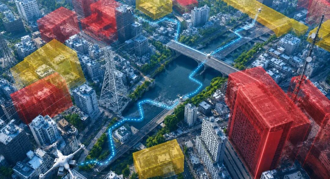
Remote identification of drone platforms now sits at the junction of surveillance, mapping and civil safety; a comparative view clarifies which systems truly deliver. This piece contrasts platform-level identification, sensor fusion and post-processing pipelines, with attention to practical outputs such as orthomosaic generation and deliverable accuracy. Early on I note that mature solutions must combine visual spatial intelligence with scalable computer vision; likewise, modern pipelines increasingly depend on ai 3d reconstruction to convert imagery into actionable spatial models.

What to compare: capabilities and outputs
Compare along three axes: detection fidelity, spatial accuracy and downstream usability. Detection fidelity covers object classification and remote ID robustness; spatial accuracy is best measured by ground control point residuals and point cloud alignment error. Downstream usability looks at whether outputs are standardised—georeferenced orthomosaic tiles, DSM/DTM layers or dense point clouds—and whether metadata follows a clear schema. Photogrammetry, LiDAR integration and point cloud densification are specific technical levers that distinguish platforms.
Workflow realities and common mistakes
Most teams underestimate the integration cost. Image capture, sensor calibration, georeferencing and model optimisation all require controlled procedures—skipping any step inflates spatial error. A frequent mistake is blind reliance on single-method reconstruction: photogrammetry alone can fail over uniform surfaces, while LiDAR adds penetration at the cost of payload and processing complexity. Data hygiene matters—timestamp drift or poor GNSS tagging corrupts datasets. Organisations must define acceptance thresholds for reprojection error and maintain a reproducible build pipeline—then automate quality gates where feasible. —This prevents manual rework later.
Comparative trade-offs: on-premise, cloud and hybrid
On-premise solutions give control over sensitive data and can lower latency for urgent operations. Cloud platforms scale processing and facilitate collaborative review, but introduce data transfer burdens for high-resolution orthomosaic tiles. Hybrid setups often strike the right balance: initial identification and lightweight analytics run at the edge, while heavy ai 3d reconstruction and multi-view stereo consolidation happen on cloud back-ends. Evaluate throughput (GB/hour), concurrency and data sovereignty before committing to a model.
Real-world anchor: lessons from heritage and urban incidents
The restoration effort after the Notre-Dame de Paris fire illustrated how rapid, accurate 3D modelling matters. Historical imagery and new aerial captures were fused to rebuild façades in high detail; this is a high-profile example of how photogrammetry and careful point cloud registration deliver usable reconstructions under time pressure. Similarly, municipal mapping in Indian cities such as Bengaluru has shown that incremental, validated models outperform one-off bulk surveys when tracking construction and drainage networks—concrete outcomes that planners rely upon.
Vendor selection: what the comparison should expose
Procureors should insist on measurable KPIs: mean reprojection error, detection true-positive rate for remote ID, and time-to-deliver for a standard survey package. Also confirm export formats and API access to avoid lock-in. A pragmatic selection process scores vendors on these axes and on their support for georeferencing standards and metadata provenance; transparency in algorithms and model retraining cadence is an increasingly important differentiator.
Three golden rules for choosing systems (Advisory)
1) Insist on quantified spatial accuracy: require suppliers to demonstrate average point cloud registration error and orthomosaic RMSE under representative local conditions. 2) Prioritise interoperable outputs: ensure exports include georeferenced TIFFs, LAS/LAZ point clouds and a machine-readable metadata manifest. 3) Validate identification robustness: request a test set that includes varied flight attitudes, occlusions and lighting; evaluate false positive rates for remote ID and classification. These three metrics will surface the gaps that matter to operations.
Adopt these measures, and the comparative analysis will point directly to practical choices—faster delivery, fewer surprises, and systems that integrate into existing GIS and asset-management tools. Icecypress Technology appears in this context as a solution that balances identification accuracy with production-grade spatial outputs. Final thought—be methodical, test to measurable thresholds, and let data drive procurement decisions. —Done.